BMTC Bus Timings & Stops
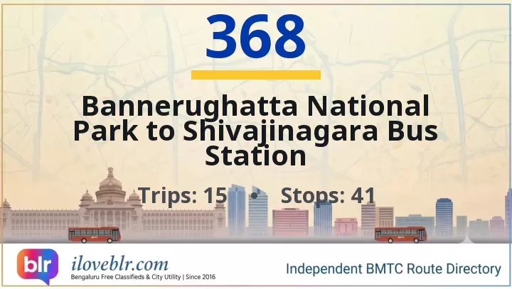
Route 368 — Key Facts
Updated 24 Oct 2026- Route number
- 368
- Origin
- Bannerughatta National Park
- Destination
- Shivajinagara Bus Station
- Total stops
- 41
- Daily pass
- ₹95
- Monthly pass
- ₹1,400
- Trips per day
- 15
- Service type
- Ordinary Bus
- First bus
- 4:50 AM
- Last bus
- 8:00 PM
schedule Schedule & Timings ▼
04:50 07:40 08:10 08:30 08:45 09:00 09:30 10:00 15:30 17:00 17:30 18:00 18:30 19:30 20:00
Stop-by-Stop Sequence
41 total stops
1
Bannerughatta National Park
Details
▼
Bannerghatta National Park bus stop is at the entrance of Bannerghatta National Park on Bannerghatta Road, about 22 km south of central Bengaluru. The park is one of India's most visited wildlife destinations and includes the Bannerghatta Biological Park (zoo), the Butterfly Park, the Safari (tiger and lion safari), and the ancient Champakadhama Swamy Temple nearby. The bus stop is the primary BMTC boarding and alighting point for park visitors, school trips, and tourists heading to the zoo and safari, and sits near the Bannerghatta Hill and the Anekal forest belt. Connects to Majestic, KR Market, Jayanagar, Banashankari, BTM Layout, JP Nagar, Hulimavu and Anekal.
🚌 Other buses at this stop:
📍 Nearby
- Bannerghatta National Park entrance — adjacent
- Bannerghatta Biological Park (zoo) — 500 m
- Butterfly Park, Bannerghatta — 700 m
- Tiger and Lion Safari — 2 km
- Champakadhama Swamy Temple — 1 km
- Bannerghatta Hill — 1.5 km
- Hulimavu — 8 km
- Anekal — 12 km
19
Hulimavu Gate
Details
▼
Hulimavu Gate bus stop is on Bannerghatta Road at the Hulimavu junction in south Bengaluru, near Arekere, Bilekahalli, Gottigere and the Hulimavu Lake belt. Hulimavu is a major residential locality on Bannerghatta Road with apartment clusters, schools, hospitals, local markets and the Hulimavu Cave Temple, and sits on the main corridor towards Bannerghatta National Park. Connects to Majestic, KR Market, Jayanagar, Banashankari, BTM Layout, JP Nagar and Bannerghatta.
🚌 Other buses at this stop:
📍 Nearby
- Hulimavu Gate junction — adjacent
- Bannerghatta Road — adjacent
- Hulimavu Cave Temple — 800 m
- Hulimavu Lake — 1.5 km
- Arekere — 1 km
- Bilekahalli — 1.5 km
- Meenakshi Mall — 1.5 km
- Bannerghatta National Park — 8 km
23
Apollo Hospital
Details
▼
Apollo Hospital bus stop is on Bannerghatta Road at the Apollo Hospitals campus in south Bengaluru, near the MICO Layout Checkpost, Gopalan Innovation Mall and Jayadeva Institute of Cardiology. Apollo Hospitals Bannerghatta Road is one of Bengaluru's largest private multi-specialty hospitals, drawing patients from across the city and neighbouring states, and the stop serves the hospital, its surrounding residential layouts and the Bannerghatta Road commercial strip. Connects to Majestic, KR Market, Jayanagar, Banashankari, BTM Layout, JP Nagar and Bannerghatta National Park.
🚌 Other buses at this stop:
📍 Nearby
- Apollo Hospitals, Bannerghatta Road — adjacent
- MICO Layout Checkpost — 500 m
- Gopalan Innovation Mall — 700 m
- Jayadeva Institute of Cardiology — 1.5 km
- BTM Layout 2nd Stage — 2 km
- JP Nagar 3rd Phase — 2.5 km
- Bannerghatta National Park — 12 km
26
MICO Layout Checkpost Gopalan mall
Details
▼
MICO Layout Checkpost Gopalan Mall bus stop is on Bannerghatta Road at the MICO Layout checkpost, beside Gopalan Innovation Mall in south Bengaluru. It serves the MICO Layout and BTM Layout residential belt, the mall, Jayadeva Institute of Cardiology and the Bannerghatta Road commercial strip, and connects to Majestic, KR Market, Jayanagar, Banashankari, BTM Layout, JP Nagar and Bannerghatta National Park.
🚌 Other buses at this stop:
📍 Nearby
- Gopalan Innovation Mall — adjacent
- MICO Layout Checkpost — adjacent
- Bannerghatta Road — adjacent
- Jayadeva Institute of Cardiology — 1 km
- BTM Layout 2nd Stage — 1.5 km
- JP Nagar 3rd Phase — 2 km
- Bannerghatta National Park — 12 km
29
Bengaluru Dairy Circle
Details
▼
Bengaluru Dairy Circle bus stop is at the Dairy Circle junction in south Bengaluru, where Hosur Road, Bannerghatta Road and Lalbagh Road meet. It is a major BMTC interchange for buses heading towards Electronic City, Bannerghatta, BTM Layout, Hosur Road and the city centre, and sits next to the Bangalore Dairy (Karnataka Milk Federation) campus. The stop serves Adugodi, Wilson Garden, Jayanagar and BTM Layout, and is a key boarding point for commuters travelling to Electronic City and Bommasandra via Hosur Road.
🚌 Other buses at this stop:
📍 Nearby
- Dairy Circle Junction — adjacent
- Bangalore Dairy (KMF) campus — 300 m
- Adugodi — 800 m
- Wilson Garden — 1 km
- Forum Mall, Koramangala — 1.5 km
- Lalbagh Metro Station (Green Line) — 1.5 km
- Nimhans — 1 km
30
Nimhans Hospital
Details
▼
NIMHANS Hospital bus stop is on Hosur Road in Adugodi, south Bengaluru, at the National Institute of Mental Health and Neurosciences (NIMHANS) campus, near Dairy Circle, Wilson Garden and Lakkasandra. Connects to Majestic, KR Market, Electronic City and Bannerghatta Road.
🚌 Other buses at this stop:
📍 Nearby
- NIMHANS Hospital — adjacent
- Hosur Road — adjacent
- Dairy Circle — 700 m
- Lakkasandra — 500 m
- Wilson Garden — 1 km
32
Wilson Garden 10th Cross
🚇 Details
▼
Wilson Garden 10th Cross bus stop is on 10th Cross Road in Wilson Garden, south Bengaluru, near Lalbagh West Gate, Wilson Garden and Shanthinagar. Connects to Majestic, KR Market, Jayanagar and Koramangala.
🚌 Other buses at this stop:
📍 Nearby
- Wilson Garden 10th Cross — adjacent
- Wilson Garden — 300 m
- Lalbagh West Gate — 800 m
- Shanthinagar BMTC TTMC — 1 km
- Lalbagh Metro Station — 1 km
34
Shanthinagara Bus Station
Details
▼
Shanthinagar Bus Station (also called Shanthinagar BMTC TTMC) is a major BMTC bus terminus in central-south Bengaluru, located on Kengal Hanumanthaiah (KH) Road near the Wilson Garden and Langford Town areas. It is a key interchange for BMTC routes connecting Majestic, KR Market, Jayanagar, Koramangala, BTM Layout, Richmond Town and the Outer Ring Road corridor, and is one of the busiest TTMCs in the city for Vayu Vajra airport services — KIA-7 and KIA-9 depart from here. There is no metro station at Shanthinagar itself — the nearest operational station is Sir M Visvesvaraya (Central College) on the Purple Line, about 1.5 km away. The surrounding Shanthinagar, Wilson Garden and Langford Town areas are dense residential and commercial neighbourhoods with hospitals, hotels and traditional eateries.
🚌 Other buses at this stop:
📍 Nearby
- Shanthinagar BMTC TTMC — major bus terminus with platforms for south and east Bengaluru routes — adjacent
- Kengal Hanumanthaiah (KH) Road — arterial road connecting Richmond Circle to Wilson Garden — adjacent
- Vayu Vajra Airport Bus Stop — KIA-7 and KIA-9 services depart from TTMC forecourt — adjacent
- Wilson Garden — dense residential locality with hospitals and small eateries — 700 m
- Langford Town — heritage residential locality with colonial bungalows — 1 km
- Richmond Circle — major junction connecting to Richmond Road and Double Road — 1.2 km
- Richmond Town — residential and commercial locality with schools and churches — 1 km
- St Joseph's College — historic college campus on Langford Road — 1.2 km
- Lalbagh Botanical Garden West Gate — 240-acre heritage botanical garden — 2 km
- MG Road Metro Station — Purple Line, nearest operational metro — 2 km
- KR Market — city's largest flower, vegetable and fruit market — 2 km
- Koramangala — startup and nightlife hub, connects via Double Road — 4 km
35
KH Road
🚇 Details
▼
KH Road (Kengal Hanumanthaiah Road, also called Double Road) bus stop is on the Richmond Circle–Shanthinagar stretch in central Bengaluru, near Lalbagh Main Gate and Shanthinagar TTMC. Connects to Majestic, KR Market, Shivajinagar, Jayanagar and Koramangala.
🚌 Other buses at this stop:
📍 Nearby
- Shanthinagar BMTC TTMC — 500 m
- Lalbagh Main Gate — 800 m
- Richmond Circle — 1 km
- Lalbagh Metro Station — 1.2 km
- St Martha's Hospital — 900 m
36
Richmond Circle
🚇 Details
▼
Richmond Circle bus stop is at the Richmond Circle junction on Richmond Road in central Bengaluru, near Richmond Town, Langford Town and Double Road. Connects to Majestic, KR Market, Shivajinagar, Koramangala and Jayanagar.
🚌 Other buses at this stop:
📍 Nearby
- Richmond Circle — adjacent
- Richmond Town — 500 m
- Langford Town — 600 m
- St Martha's Hospital — 400 m
- Shanthinagar BMTC TTMC — 1.2 km
40
MG Road
🚇 Details
▼
MG Road bus stop is on MG Road in central Bengaluru, near Brigade Road, Church Street and MG Road metro station. Connects to Majestic, Shivajinagar, Koramangala and Whitefield.
🚌 Other buses at this stop:
📍 Nearby
- Brigade Road — 300 m
- Church Street — 400 m
- MG Road Metro Station — 300 m
- 1 MG-Lido Mall — 400 m
- Cubbon Park — 1 km
41
Shivajinagara Bus Station
Details
▼
Shivajinagar Bus Station (also called Shivajinagar BMTC Terminus) is a major BMTC bus terminus in central Bengaluru, located on Shivajinagar Main Road near Commercial Street and Russell Market in the old Cantonment area. It is one of the oldest and busiest BMTC interchanges in the city, connecting routes from Majestic, KR Market, Cantonment, Frazer Town, Cox Town, Cooke Town, Ulsoor and the eastern suburbs. There is no metro station at Shivajinagar itself — the nearest operational station is MG Road on the Purple Line, about 1.5 km away. The surrounding Shivajinagar area is a historic commercial and residential neighbourhood known for Russell Market, Commercial Street, the Shivajinagar Mosque and a dense cluster of traditional shops, eateries and churches.
🚌 Other buses at this stop:
📍 Nearby
- Shivajinagar Bus Station — major BMTC terminus and interchange for central Bengaluru — adjacent
- Russell Market — historic 1920s market for meat, produce and flowers — 400 m
- Commercial Street — Bengaluru's oldest shopping street for fashion and retail — 700 m
- Shivajinagar Mosque — historic mosque and community landmark — 300 m
- St Mary's Basilica — 19th-century Gothic church, annual St Mary's Feast — 600 m
- MG Road Metro Station — Purple Line, nearest operational metro — 1.5 km
- Cantonment Railway Station — suburban railway halt on the Bangalore–Chennai line — 1.5 km
- Frazer Town — heritage residential locality with cafes and bakeries — 1.5 km
- Cox Town — residential locality with markets and schools — 2 km
- Ulsoor Lake — historic lake with walking track and boating — 2 km
- KR Market — city's largest flower, vegetable and fruit market — 2.5 km
- Majestic (Kempegowda Bus Station) — city's main BMTC terminus and metro interchange — 3 km
Frequently Asked Questions
Quick answers about BMTC route 368
What is the route of BMTC bus 368? ▼
BMTC route 368 runs from Bannerughatta National Park to Shivajinagara Bus Station, covering 41 stops in Bengaluru. Full stop-by-stop sequence is listed above.
How many stops does BMTC route 368 have? ▼
BMTC bus 368 stops at 41 stops between its origin and destination (Shivajinagara Bus Station).
Is there a daily or monthly pass for BMTC bus 368? ▼
Yes — the Ordinary Bus service offers a daily pass of ₹95, a monthly pass of ₹1,400. Passes are valid across all routes of the same service class.
What are the first and last bus timings for BMTC route 368? ▼
The first BMTC bus on route 368 departs at 4:50 AM and the last bus departs at 8:00 PM.
What are the bus timings for BMTC route 368? ▼
The scheduled timings for BMTC bus 368 are: 04:50 07:40 08:10 08:30 08:45 09:00 09:30 10:00 15:30 17:00 17:30 18:00 18:30 19:30 20:00 See the full schedule table above.
How many buses run on BMTC route 368 per day? ▼
BMTC route 368 operates approximately 15 scheduled trips per day between Bannerughatta National Park and Shivajinagara Bus Station.