BMTC Bus Timings & Stops
Rent-Buy-Sell Homes & PGs
Find your perfect home, flatmate, or PG accommodation easily.
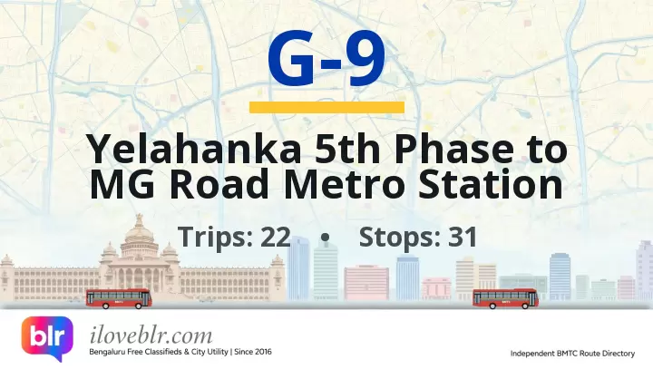
Route G-9 — Key Facts
Updated 12 Oct 2026- Route number
- G-9
- Origin
- Yelahanka 5th Phase
- Destination
- MG Road Metro Station
- Total stops
- 31
- Daily pass
- ₹95
- Monthly pass
- ₹1,400
- Trips per day
- 22
- Service type
- Ordinary Bus
- First bus
- 6:10 AM
- Last bus
- 5:40 PM
schedule Schedule & Timings ▼
06:10 06:30 06:50 07:10 07:50 08:10 08:25 08:55 09:15 09:35 09:55 10:15 13:50 14:10 14:30 14:40 15:40 16:20 16:40 17:00 17:30 17:40
Stop-by-Stop Sequence
31 total stops
1
Yelahanka 5th Phase
✈️
▼
Yelahanka 5th Phase bus stop is in Yelahanka 5th Phase, a residential layout in north Bengaluru, near Yelahanka New Town, Attur Layout and the Bellary Road (NH 44) corridor. It serves the 5th Phase residential blocks, apartment clusters, schools and local markets, and connects commuters to Hebbal, Majestic, Devanahalli and Kempegowda International Airport.
📍 Nearby
- Yelahanka 5th Phase — adjacent
- Yelahanka New Town — 1.5 km
- Attur Layout — 2 km
- Yelahanka Satellite Town — 2 km
- Bellary Road (NH 44) — 2 km
- Yelahanka Bus Stand — 3 km
5
Yelahanka Satellite Town
✈️
▼
Yelahanka Satellite Town bus stop is in Yelahanka Satellite Town, a planned BDA residential layout in north Bengaluru, near Yelahanka New Town, Allalasandra and the Bellary Road (NH 44) corridor. The Satellite Town is one of Yelahanka's largest residential layouts, with parks, schools, colleges, local markets and apartment clusters, and serves commuters heading to Hebbal, Majestic, Devanahalli, Doddaballapura and Kempegowda International Airport.
📍 Nearby
- Yelahanka Satellite Town — adjacent
- Yelahanka New Town — 1 km
- Allalasandra — 1.5 km
- Yelahanka Bus Stand — 2 km
- Bellary Road (NH 44) — 1.5 km
- Kogilu Cross — 3.5 km
14
Byatarayanapura
▼
Byatarayanapura bus stop is in Byatarayanapura, north Bengaluru, on Bellary Road (NH 44) near Kodigehalli, Sahakarnagar and Yelahanka. It is a major residential locality and assembly constituency, with the Byatarayanapura Lake and several apartment clusters nearby. Connects to Majestic, Hebbal, Yelahanka and the airport corridor.
📍 Nearby
- Byatarayanapura — adjacent
- Bellary Road (NH 44) — adjacent
- Byatarayanapura Lake — 800 m
- Kodigehalli — 1 km
- Sahakarnagar — 1.5 km
- Hebbal Flyover — 3 km
22
Mekhri Circle
▼
Mekhri Circle bus stop is at the Mekhri Circle junction in north-central Bengaluru, where Jayamahal Road, Bellary Road (NH 44) and Sankey Road meet at the start of the Hebbal flyover. It is a major interchange for buses heading north towards Hebbal, Yelahanka, Devanahalli and Kempegowda International Airport, and south towards Majestic and MG Road. Near Bangalore Golf Club, Sadashivanagar, RMV Extension and Jayamahal Palace. Connects to Majestic, Shivajinagar, Hebbal, Yelahanka and the airport.
📍 Nearby
- Mekhri Circle Junction — adjacent
- Hebbal Flyover (start) — 500 m
- Bangalore Golf Club — 700 m
- Sadashivanagar — 800 m
- RMV Extension — 1 km
- Cantonment Railway Station — 2 km
- Cubbon Park Metro Station — 3 km
26
Cantonment Railway Station
▼
Cantonment Railway Station bus stop is on Millers Road in central Bengaluru, at the Cantonment Railway Station on the Bangalore–Chennai suburban line, near Vasanth Nagar, Frazer Town and Cunningham Road. Connects to Majestic, Shivajinagar, KR Market and Yeshwantpur.
🚌 Other buses at this stop:
📍 Nearby
- Cantonment Railway Station — adjacent
- Vasanth Nagar — 500 m
- Millers Road — adjacent
- Cunningham Road — 800 m
- Frazer Town — 1 km
29
Cubbon Park Metro Station
🚇
▼
The Cubbon Park Metro Station bus stop sits directly outside Cubbon Park metro station on the Purple Line (Kengeri–Whitefield), on Kasturba Road at the edge of Cubbon Park in central Bengaluru. It connects BMTC buses from MG Road, Richmond Circle, Shivajinagar, Majestic and Koramangala to the Purple Line, and is one of the most centrally located metro stops in the city. The stop is a short walk from Cubbon Park, Chinnaswamy Stadium, Visvesvaraya Industrial and Technological Museum, Karnataka State Library and the MG Road commercial district, making it a key stop for tourists, office workers and students.
🚌 Other buses at this stop:
📍 Nearby
- Cubbon Park Metro Station — Purple Line (Kengeri–Whitefield), directly at this stop — adjacent
- Cubbon Park — 300-acre heritage park with walking tracks and toy train — 200 m
- Kasturba Road — arterial road connecting MG Road to Richmond Circle — adjacent
- Chinnaswamy Stadium — Karnataka cricket stadium and match venue — 400 m
- Visvesvaraya Industrial and Technological Museum — science and technology museum — 500 m
- Karnataka State Central Library — historic public library, Cubbon Park — 600 m
- MG Road Metro Station — Purple Line, next station towards Whitefield — 1.2 km
- Vidhana Soudha — Karnataka state legislature building and landmark — 1 km
- High Court of Karnataka — red-brick heritage court building — 800 m
- Bengaluru Aquarium — public aquarium on Kasturba Road — 500 m
- UB City Mall — luxury retail and dining complex on Vittal Mallya Road — 1.2 km
- MG Road — Bengaluru's historic commercial and shopping street — 1 km
31
MG Road Metro Station
🚇
▼
The MG Road Metro Station bus stop sits directly outside MG Road metro station on the Purple Line (Kengeri–Whitefield), on MG Road at the junction with Trinity Circle and Brigade Road in central Bengaluru. It is one of the busiest metro interchanges in the city, connecting BMTC buses from Majestic, Shivajinagar, Koramangala, Indiranagar and Whitefield to the Purple Line. MG Road is Bengaluru's historic commercial spine, lined with shopping complexes, hotels, restaurants and offices, and the stop is a short walk from Brigade Road, Church Street and Cubbon Park.
🚌 Other buses at this stop:
📍 Nearby
- MG Road Metro Station — Purple Line (Kengeri–Whitefield), directly at this stop — adjacent
- MG Road — Bengaluru's historic commercial and shopping street — adjacent
- Brigade Road — retail, dining and nightlife street — 400 m
- Church Street — cafes, pubs and bookstores — 500 m
- Trinity Metro Station — Purple Line, next station towards Whitefield — 1.2 km
- Cubbon Park — 300-acre heritage park with walking tracks — 1.5 km
- 1 MG-Lido Mall — retail and multiplex mall on MG Road — 300 m
- Bangalore Central Mall — shopping and entertainment complex on MG Road — 500 m
- The Oberoi Bengaluru — luxury hotel on MG Road — 600 m
- Vivanta Bengaluru, MG Road — hotel and dining destination — 700 m
- Barton Centre — heritage commercial building on MG Road — 200 m
- Vidhana Soudha — Karnataka state legislature building — 2 km
Frequently Asked Questions
Quick answers about BMTC route G-9
What is the route of BMTC bus G-9? ▼
BMTC route G-9 runs from Yelahanka 5th Phase to MG Road Metro Station, covering 31 stops in Bengaluru. Full stop-by-stop sequence is listed above.
How many stops does BMTC route G-9 have? ▼
BMTC bus G-9 stops at 31 stops between its origin and destination (MG Road Metro Station).
Is there a daily or monthly pass for BMTC bus G-9? ▼
Yes — the Ordinary Bus service offers a daily pass of ₹95, a monthly pass of ₹1,400. Passes are valid across all routes of the same service class.
What are the first and last bus timings for BMTC route G-9? ▼
The first BMTC bus on route G-9 departs at 6:10 AM and the last bus departs at 5:40 PM.
What are the bus timings for BMTC route G-9? ▼
The scheduled timings for BMTC bus G-9 are: 06:10 06:30 06:50 07:10 07:50 08:10 08:25 08:55 09:15 09:35 09:55 10:15 13:50 14:10 14:30 14:40 15:40 16:20 16:40 17:00 17:30 17:40 See the full schedule table above.
How many buses run on BMTC route G-9 per day? ▼
BMTC route G-9 operates approximately 22 scheduled trips per day between Yelahanka 5th Phase and MG Road Metro Station.