BMTC Bus Timings & Stops

Buy & sell in Bengaluru
Explore free classified ads for items, furniture, and more near you.
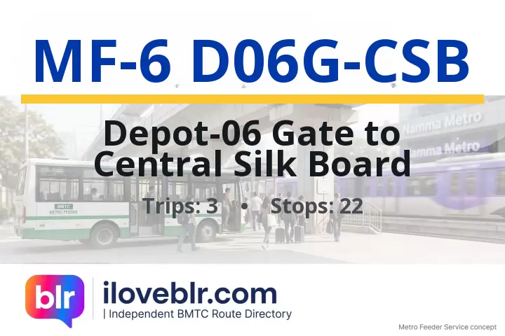
Route MF-6 D06G-CSB — Key Facts
Updated 23 Oct 2026- Route number
- MF-6 D06G-CSB
- Origin
- Depot-06 Gate
- Destination
- Central Silk Board
- Total stops
- 22
- Trips per day
- 3
- Service type
- BMTC Transit Route
- First bus
- 7:27 AM
- Last bus
- 7:37 AM
schedule Schedule & Timings ▼
07:27 07:31 07:37
Stop-by-Stop Sequence
22 total stops
2
Binnamangala
🚇
▼
Binnamangala bus stop is in Binnamangala, east Bengaluru, the older name for the Indiranagar area, near 100 Feet Road, Old Madras Road and Indiranagar metro station. Connects to Majestic, KR Market, Shivajinagar and Whitefield.
📍 Nearby
- Binnamangala — adjacent
- 100 Feet Road, Indiranagar — 500 m
- Old Madras Road — 800 m
- Indiranagar Metro Station — 800 m
- CMH Road — 1 km
3
Swamy Vivekananda Metro Station
🚇
▼
The Swamy Vivekananda Metro Station bus stop sits directly outside Swami Vivekananda Road (SVR) metro station on the Purple Line (Kengeri–Whitefield), on Old Madras Road (NH 75) near the junction with Swami Vivekananda Road in east Bengaluru. It connects BMTC buses from Ulsoor, Indiranagar, Domlur, CV Raman Nagar and Old Madras Road to the Purple Line, and serves the dense residential and commercial neighbourhoods of Halasuru, Jogupalya and Subramanyapura. The stop is a key interchange for commuters heading towards MG Road, Majestic and Whitefield, and is close to Ulsoor Lake, Bangalore East railway station and the Old Madras Road business corridor.
📍 Nearby
- Swami Vivekananda Road Metro Station — Purple Line (Kengeri–Whitefield), directly at this stop — adjacent
- Old Madras Road (NH 75) — arterial highway towards KR Puram and Hoskote — adjacent
- Swami Vivekananda Road — connects Old Madras Road to Ulsoor and CV Raman Nagar — adjacent
- Ulsoor Lake — historic lake with walking track and boating — 1.2 km
- Halasuru (Ulsoor) Metro Station — Purple Line, next station towards Majestic — 1.2 km
- Indiranagar Metro Station — Purple Line, next station towards Whitefield — 1.2 km
- Bangalore East Railway Station — suburban railway halt, Old Madras Road — 1 km
- CMH Road — shopping street for textiles and electronics, Indiranagar — 1.5 km
- Jogupalya — residential locality with local markets and eateries — 800 m
- Domlur — residential and IT locality, connects via Old Airport Road — 2 km
- CV Raman Nagar — residential and defence locality with markets — 2.5 km
- Toit Brewpub and 100 Feet Road — Indiranagar's pub street and dining hub — 1.5 km
4
Swamy Vivekananda Metro Station
🚇
▼
The Swamy Vivekananda Metro Station bus stop sits directly outside Swami Vivekananda Road (SVR) metro station on the Purple Line (Kengeri–Whitefield), on Old Madras Road (NH 75) near the junction with Swami Vivekananda Road in east Bengaluru. It connects BMTC buses from Ulsoor, Indiranagar, Domlur, CV Raman Nagar and Old Madras Road to the Purple Line, and serves the dense residential and commercial neighbourhoods of Halasuru, Jogupalya and Subramanyapura. The stop is a key interchange for commuters heading towards MG Road, Majestic and Whitefield, and is close to Ulsoor Lake, Bangalore East railway station and the Old Madras Road business corridor.
📍 Nearby
- Swami Vivekananda Road Metro Station — Purple Line (Kengeri–Whitefield), directly at this stop — adjacent
- Old Madras Road (NH 75) — arterial highway towards KR Puram and Hoskote — adjacent
- Swami Vivekananda Road — connects Old Madras Road to Ulsoor and CV Raman Nagar — adjacent
- Ulsoor Lake — historic lake with walking track and boating — 1.2 km
- Halasuru (Ulsoor) Metro Station — Purple Line, next station towards Majestic — 1.2 km
- Indiranagar Metro Station — Purple Line, next station towards Whitefield — 1.2 km
- Bangalore East Railway Station — suburban railway halt, Old Madras Road — 1 km
- CMH Road — shopping street for textiles and electronics, Indiranagar — 1.5 km
- Jogupalya — residential locality with local markets and eateries — 800 m
- Domlur — residential and IT locality, connects via Old Airport Road — 2 km
- CV Raman Nagar — residential and defence locality with markets — 2.5 km
- Toit Brewpub and 100 Feet Road — Indiranagar's pub street and dining hub — 1.5 km
10
Indiranagara 100ft Road
🚇
▼
Indiranagar 100 Feet Road bus stop is on 100 Feet Road (Paramahansa Yogananda Road) in Indiranagar, east Bengaluru, near Indiranagar metro station, 12th Main and CMH Road. Connects to Majestic, KR Market, Shivajinagar, Koramangala and Whitefield.
📍 Nearby
- 100 Feet Road, Indiranagar — adjacent
- Indiranagar Metro Station — 500 m
- 12th Main Indiranagar — 500 m
- CMH Road — 700 m
- Toit Brewpub — 600 m
11
Dhoopanahalli
🚇
▼
Dhoopanahalli bus stop is in Dhoopanahalli, a locality in east Bengaluru near Domlur, Indiranagar and Old Airport Road. Connects to Majestic, Shivajinagar, KR Market and Whitefield.
📍 Nearby
- Dhoopanahalli — adjacent
- Domlur — 600 m
- Indiranagar — 800 m
- Old Airport Road — 1 km
- Indiranagar Metro Station — 1 km
12
Domlur Flyover
▼
Domlur Flyover bus stop is on Old Airport Road at the Domlur flyover in east Bengaluru, near Domlur, Kodihalli, Indiranagar and the Inner Ring Road junction. Serves the Old Airport Road business and residential corridor, and connects to Majestic, Shivajinagar, KR Market, Electronic City, Whitefield and Kempegowda International Airport via the airport road.
📍 Nearby
- Domlur Flyover — adjacent
- Old Airport Road — adjacent
- Domlur — 500 m
- Kodihalli — 1 km
- Indiranagar — 1.5 km
- Inner Ring Road Junction — 800 m
13
Dell Domluru
▼
Dell Domluru bus stop serves the Dell Technologies campus on the Domlur side of Inner Ring Road in east Bengaluru, near Domlur, Ejipura, Koramangala and the Embassy Golf Links business park. It is used by Dell employees and the surrounding office workforce at Embassy Golf Links, Diamond District and the Inner Ring Road tech corridor, and connects commuters to Majestic, Shivajinagar, KR Market, Indiranagar and Whitefield.
📍 Nearby
- Dell Technologies campus, Domlur — adjacent
- Inner Ring Road — adjacent
- Domlur — 700 m
- Embassy Golf Links Business Park — 1.5 km
- Ejipura — 1.5 km
- Koramangala — 2 km
- Indiranagar Metro Station (Purple Line) — 2 km
15
Shrinivagilu Ejipura
▼
Shrinivagilu Ejipura bus stop is in Shrinivagilu, on the Ejipura side of Koramangala 1st Block, south-east Bengaluru, near Ejipura Main Road, Vivek Nagar and Koramangala. It serves the dense residential and commercial blocks of Ejipura, Shrinivagilu, Koramangala 1st Block and Austin Town, and connects commuters to Majestic, Shivajinagar, KR Market, Koramangala and Indiranagar.
📍 Nearby
- Shrinivagilu — adjacent
- Ejipura — 400 m
- Koramangala 1st Block — 800 m
- Vivek Nagar — 1 km
- Forum Mall, Koramangala — 1.5 km
- Indiranagar Metro Station (Purple Line) — 3 km
21
Madivala
🚇
▼
Madiwala bus stop is in Madiwala, south-east Bengaluru, on Hosur Road near Madiwala Market, Silk Board Junction and BTM Layout. Madiwala is a major BMTC interchange and one of south Bengaluru's largest vegetable and produce markets, serving commuters from Koramangala, BTM Layout, HSR Layout, Bommanahalli and Electronic City. Connects to Majestic, KR Market, Shivajinagar, Electronic City and Whitefield.
📍 Nearby
- Madiwala Market — large vegetable and produce market, one of south Bengaluru's biggest — adjacent
- Hosur Road — arterial highway towards Electronic City and Hosur — adjacent
- Silk Board Junction — major Hosur Road / ORR bottleneck — 1.5 km
- BTM Layout — residential and startup locality — 1.5 km
- Koramangala — startup and nightlife hub — 2 km
- Central Silk Board Metro Station — 1.5 km
- Forum Mall, Koramangala — 2 km
22
Central Silk Board
🚇
▼
Central Silk Board bus stop is at the Central Silk Board junction in south-east Bengaluru, where Hosur Road (NH 44) meets the Outer Ring Road — one of the busiest and most congested traffic nodes in the city. It sits directly below the Central Silk Board flyover, outside the Karnataka Silk Board head office, and serves as a major BMTC interchange for commuters heading to Electronic City, BTM Layout, HSR Layout, Koramangala, Bommanahalli and Marathahalli. The Central Silk Board metro station on the Yellow Line is at the junction, and the surrounding area has dense residential blocks, offices, hospitals and the Madiwala market belt.
📍 Nearby
- Central Silk Board junction — adjacent
- Central Silk Board Metro Station (Yellow Line) — adjacent
- Central Silk Board (Karnataka Silk Board office) — adjacent
- Silk Board Flyover — adjacent
- Hosur Road (NH 44) — adjacent
- Outer Ring Road — adjacent
- BTM Layout — 1.5 km
- HSR Layout — 1.5 km
- Madiwala Market — 1.5 km
- Bommanahalli — 2.5 km
- Koramangala — 3 km
Frequently Asked Questions
Quick answers about BMTC route MF-6 D06G-CSB
What is the route of BMTC bus MF-6 D06G-CSB? ▼
BMTC route MF-6 D06G-CSB runs from Depot-06 Gate to Central Silk Board, covering 22 stops in Bengaluru. Full stop-by-stop sequence is listed above.
How many stops does BMTC route MF-6 D06G-CSB have? ▼
BMTC bus MF-6 D06G-CSB stops at 22 stops between its origin and destination (Central Silk Board).
What are the first and last bus timings for BMTC route MF-6 D06G-CSB? ▼
The first BMTC bus on route MF-6 D06G-CSB departs at 7:27 AM and the last bus departs at 7:37 AM.
What are the bus timings for BMTC route MF-6 D06G-CSB? ▼
The scheduled timings for BMTC bus MF-6 D06G-CSB are: 07:27 07:31 07:37 See the full schedule table above.
How many buses run on BMTC route MF-6 D06G-CSB per day? ▼
BMTC route MF-6 D06G-CSB operates approximately 3 scheduled trips per day between Depot-06 Gate and Central Silk Board.
What type of bus service is BMTC route MF-6 D06G-CSB? ▼
BMTC route MF-6 D06G-CSB is operated as a BMTC Transit Route within Bengaluru's BMTC city bus network.